1839 Ava earthquake
Earthquake in British IndiaThe 1839 Ava earthquake, also known as the Amarapura earthquake or Inwa earthquake, was a disastrous seismic event that struck present-day central Myanmar on March 23. This earthquake with an estimated moment magnitude as high as 8.3, was one of the largest in the country, since 1762. It was assigned a maximum of XI (Extreme) on the Modified Mercalli intensity scale, and was felt in Rangoon and Bhamo. Damage was enormous in Ava, resulting in the death of hundreds.
Read article

.jpg)


,_Mandalay_20.jpg)
_Myanmar(Burma).jpg)

Top Questions
AI generatedMore questions
Nearby Places

Sagaing
Town in Sagaing Region, Myanmar
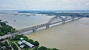
Irrawaddy Bridge
Bridge in Mandalay Division, Burma

The Wachet Jivitadana Sangha Hospital
Hospital in Upper Myanmar, Myanmar
Yadana Zedi Sinmya Shin Pagoda
Buddhist Pagoda in Myanmar

Ma Shi Khana Pagoda

Sun U Ponnyashin Pagoda
Buddhist Pagoda in Sagaing City, Myanmar

Umin Thonze Pagoda
Buddhist pagoda in Myanmar

Sitagu International Buddhist Academy